 After my visit to the Lilydale Falls (on the Second River) on Sunday, I was having a written discussion with a friend who pointed out the three blue lines (i.e.,three waterfalls) on the map at Lilydale, rather than just two. He asked if I’d seen the third. I said I thought the first line was where I had photographed the children having a look at pretty cascades (hardly a waterfall), and sent him a copy; the second line would then be the lower falls, and the third, the upper. But. BUT. What if he were right, and I, wrong, and there was another waterfall higher up? What fun!! The ListMap he was using was manifestly incorrect, as it had the track on the wrong side of the river in places, and things just didn’t match. But that didn’t rule out a third waterfall. Only a visit would resolve this issue.

I decided I wanted to go there today and clear up this matter. I have now had four runs in succession since beginning back after the flu, and it would be good for me to walk instead today. Lilydale is nice and close, so I wouldn’t waste too much time. Off I set. I don’t usually track simple tourist routes on a track, but thought I would track today, just in case there was a third, and tracking would clear up the position of the others once and for all. After just a few minutes, I had crossed the bridge and reached the first falls. Oh, drat. As I thought. I was now at the middle of the three blue lines, which meant, of course, the next waterfall would be the third, and there would be no pleasant surprise hidden above it. However, I might as well climb up and see what there is to be seen: a new view, which is always pleasant. There was no sign of waterfall-like territory beyond where I went up there.
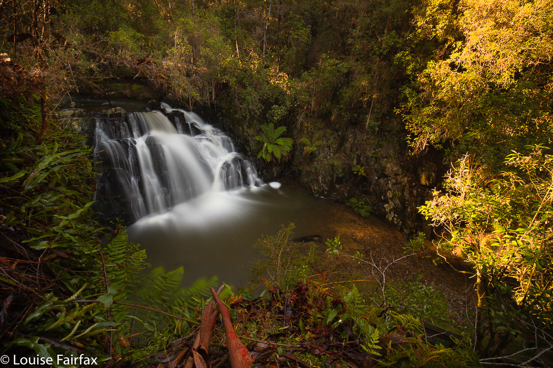
On my backtrack, I stopped at the first blue line, and photographed the pretty cascades (above), which are all of 25 cms high. The map here does not match the ground in any way, and even the position of the river is incorrect. Anyway, the mystery was now solved. (See map below).
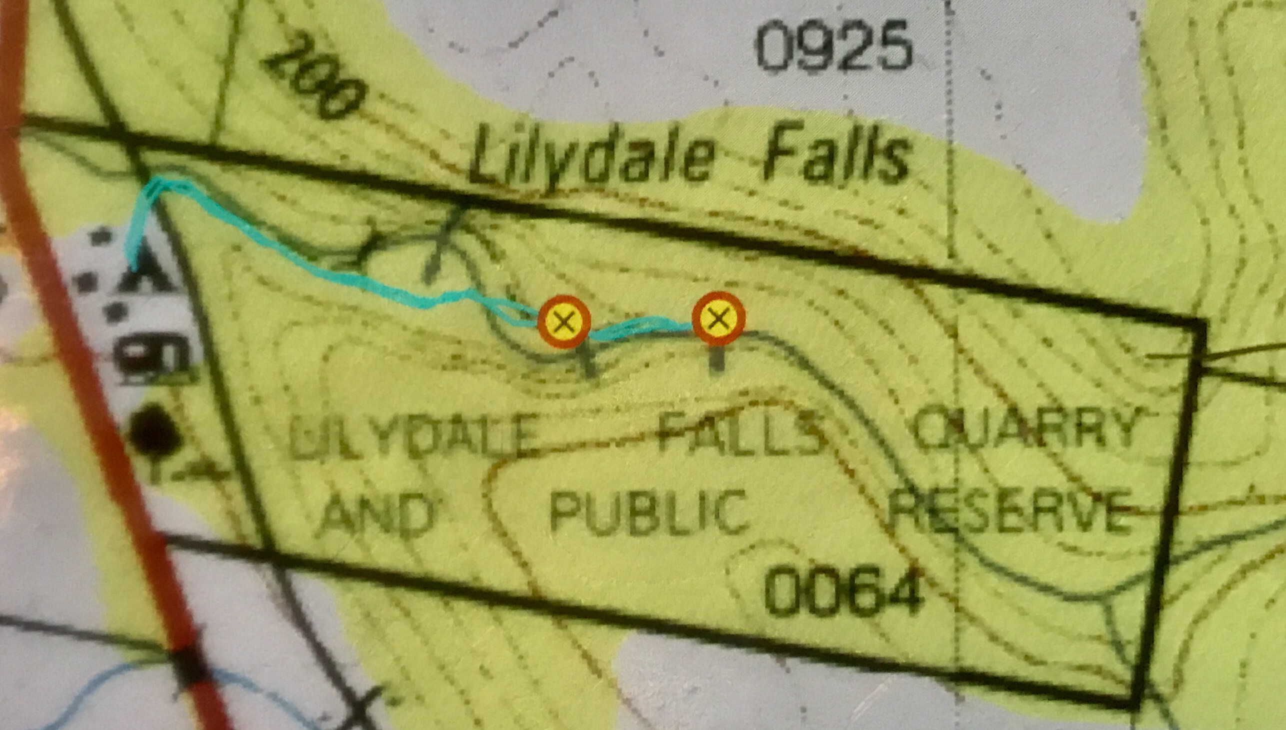
The cyan line is where I went, and marks the actual track on the ground. The mystery third line is there under the L of Lilydale, in the “creek” that actually isn’t quite there. See how the map has the river curving away? I assure you I had one foot in the river to take the photo, which is as near to that line as I could get whilst still being in the river. Map and ground are not in sync. The bridge on the map is not there. There is a bridge not on the map shortly before the lower falls. Sometimes Tasmanian maps are an embarrassment.
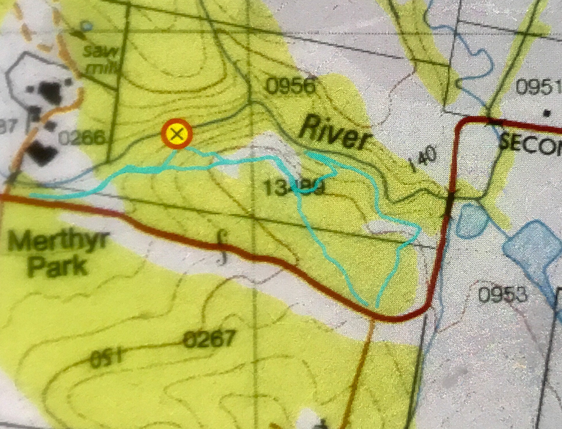
I had not had nearly enough exercise, so deviated right before I got back into Lilydale, and drove the 2kms to Merthyr Reserve, which has a trail that runs kind of near the Second River’s continuation, and descends to it in places. I found this track utterly frustrating, as you can hear, but not see, the river from it. What is the point of that? I kept having to bushbash off to my right in order to see if there was anything promising “down there”. I lost count of the number of attempts to find something worth photographing, but at last, on my way back, found the little cascade of the photo, which I have imaginatively named Merthyr Cascades.

It, like many others, was a bushbash, but if you read my map below and go to that place (which I have marked with a waypoint), you too will find the nearest thing I found to a waterfall in this reserve. The forest here is dry sclerophyll, which is not my favourite forest, but at least it provided forty minutes’ exercise by the time I’d walked the small and large loops and gone up and down the contours in search of cascades. Pink heath plants were in flower, which gave the forest some colour. It could be a nice reserve if the trail went somewhere near the water. There might even be nice swimming holes in summer.