
 Mt Parmeener is neither pretty nor dramatic. Perhaps worse for its popularity, nobody has allocated it a point, and despite its offical 1286 ms above sea level elevation (peak baggers’ master sheet incorrectly says 1280; other websites incorrectly say 1270) it fails on other criteria to be an Abel. Lots of people and things are neither pretty nor dramatic, nor worth a point in some random system, but they are still interesting for other reasons, and well worth our engagement. Mt Parmeener is one such.
The view west
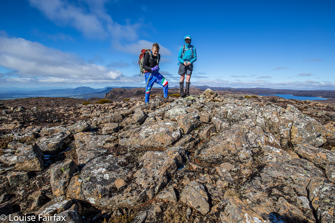
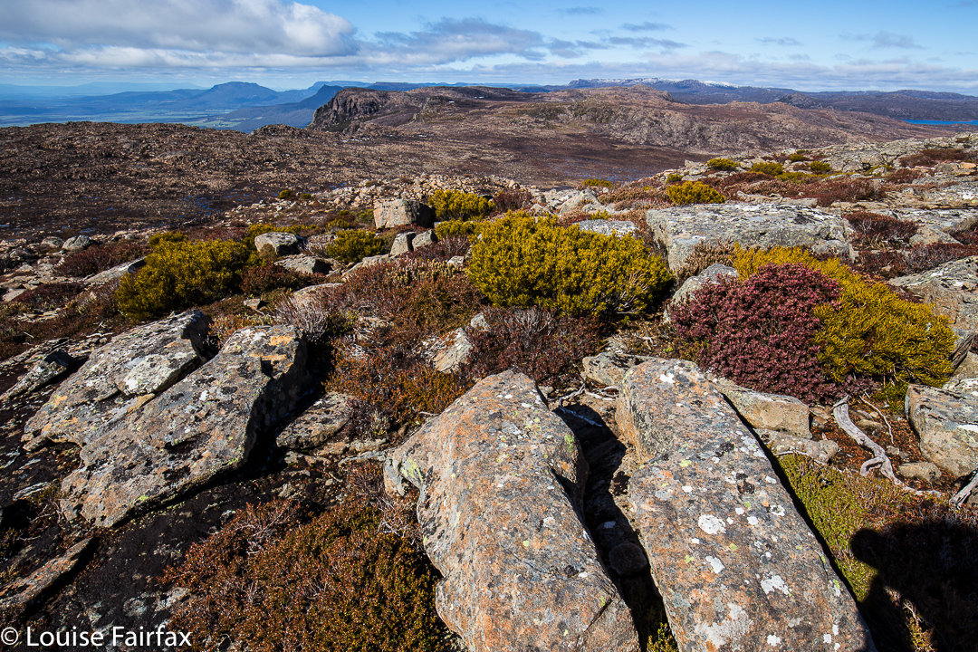
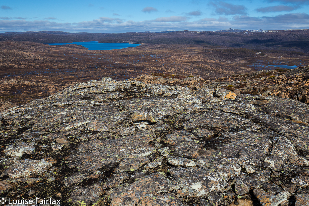
Its altitude, if nothing else, should hint at its expansive views. Being right on the edge of the escarpment, it looks out north over the Mole Creek region far, far below. Looking west, we could see snow on Ossa and Pelion East. To our south, the Walls covered in snow were visible, and to the east, Quamby Bluff’s distinctive shape called to us, as well as sharp bluffs along the escarpment’s piped edge. It felt airy and wild up there. The wind was cold, but we were not blasted out of existence, and enjoyed the feeling of space along the top.
We drove south from Mole Creek, on a road imaginatively named South Mole Creek Rd. Road names are a little confusing, as different maps call the roads a variety of names, but one thing stands firm: you want Blairs Road, and it is correctly named on all the maps I’ve consulted. We headed south from Mole Creek, as said, and after about two kilometres, turned right (west) onto a road that ran into Blairs Rd at a left hand turn that had us heading south again (named on the map). We followed Blairs Rd for several kms, through what appeared to be a farm, and on, into the forest … and up. Had there not been a big flood recently, it would have been possible to have driven to a boom gate. Now you have to stop short of that, but not too far short; fallen trees and soft ground made further driving impossible. For walkers, however, they just add a bit of fun and challenge.
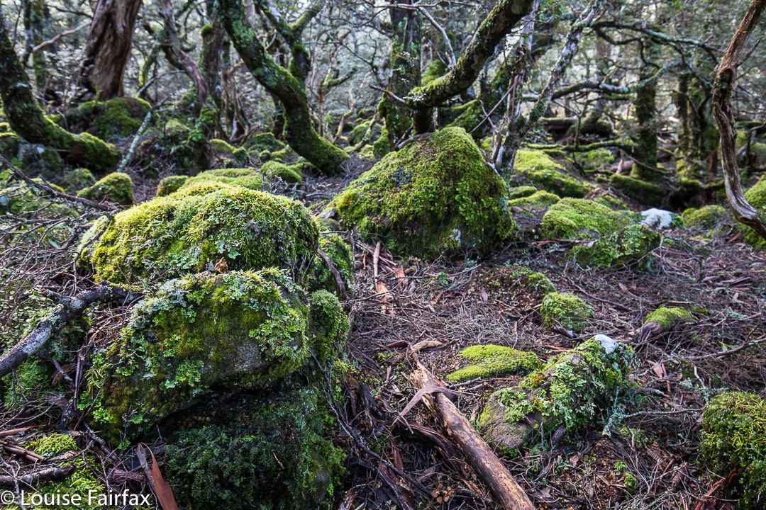
The track takes you up through beautiful myrtle forest.
Beyond the boom gate (which informs you that dangerous fires are raging ahead and you should not enter), the road morphs into an old stock route – South Mole Creek Track – where cattle could have walked three abreast in some places, only single file in others. This route takes you on the gentlest of inclines up onto the escarpment. I was stunned to read we had climbed over 500ms (to the escarpment; 660 ms in total). We took around 2 hours from the car to the end of the steep climb, and a further 30 minutes from breasting the rise to our actual summit, further to the east of our emergence point on the tops. Once up onto the escarpment, the climb to the summit is minimal. Spaces were open, the air was fresh; it was great wandering along deciding which gully we’d use to attack the final rise.
 My husband, with ever-worsening Parkinson’s disease, made it to the summit without any problems, so I would classify this as a very pleasant and doable family walk. At this time of year there was abundant water on top (flippers were more necessary than a water bottle). Given the many access problems posed by this winter’s floods, I recommend this track as something that remains reachable when so much else is closed off.
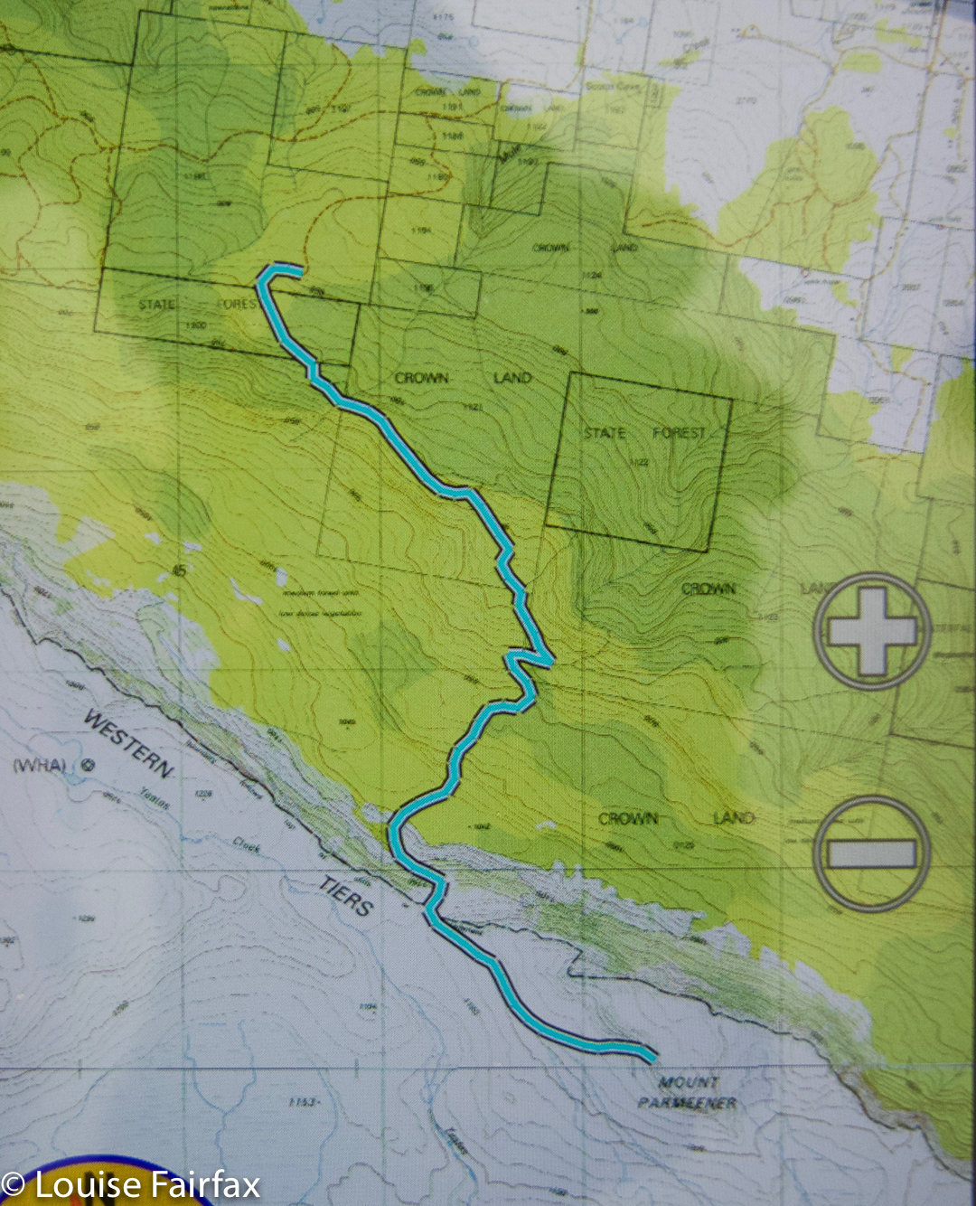 Mt Parmeener, route.