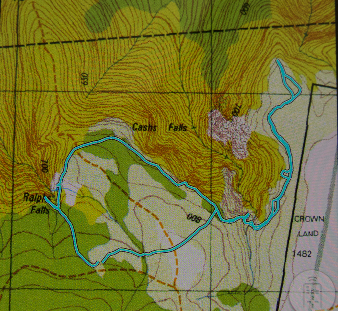
Ralphs Falls, Feb 2018.
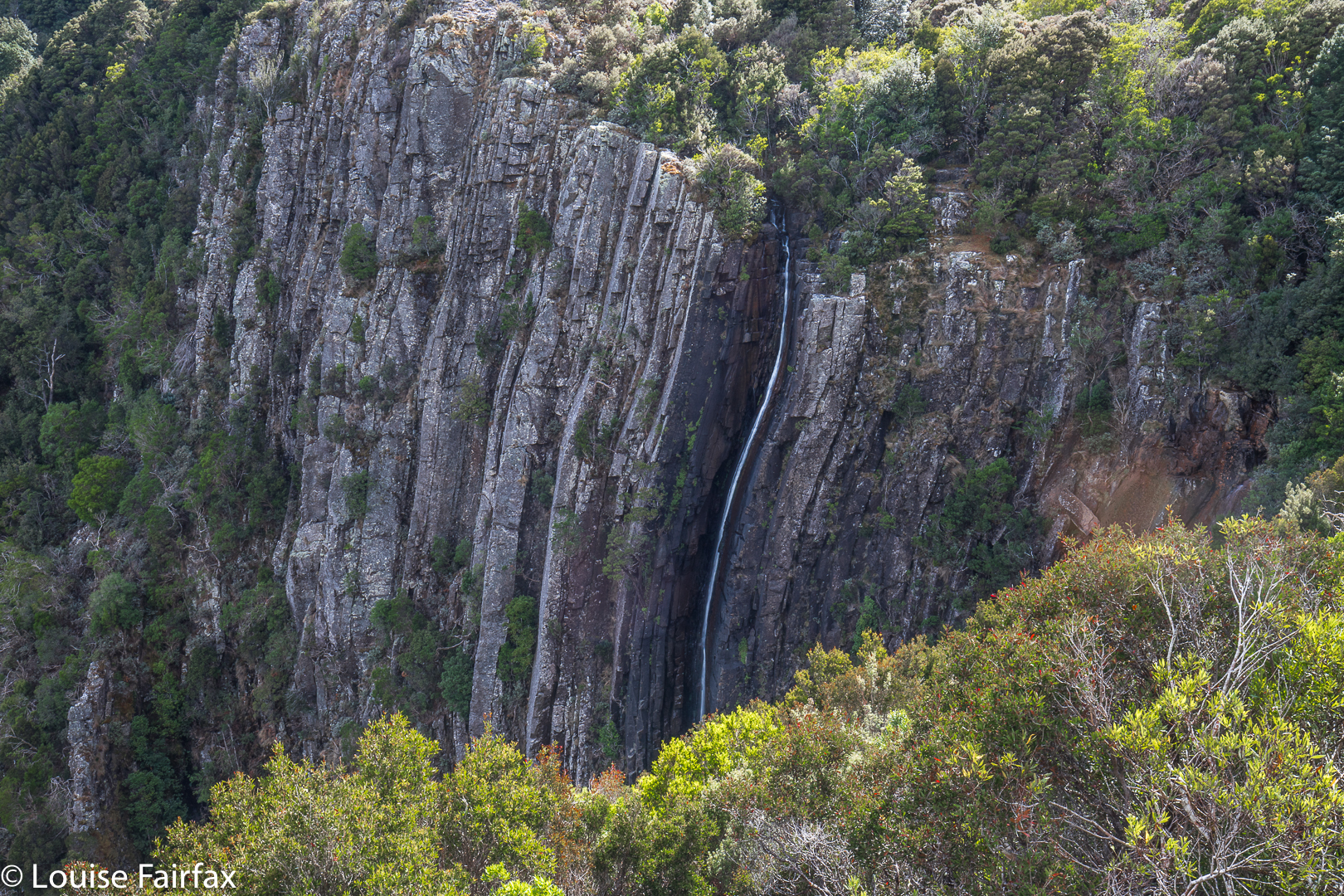
I didn’t think that the walk to Ralphs Falls was going to be particularly exciting (being a mere six minutes along a track from the carpark), or that the falls themselves would offer much, being a thin sliver down a brown cliff, but I am one of those thorough types and I like to see everything at least once for myself. I didn’t think Ralphs would be exciting at any time of year, so why not do it in summer? At least we’d had some rain last week. You never know your luck. And if we’d been certain of a big flow somewhere, I can think of much better places to be than a waterfall that has a single narrow line of water dropping into a space that you can’t see below. So, our adventure for this week would be Ralphs Falls, an attempt at Cashs (or at least a viewing of the Cashs Gorge), and then Alberton Falls.
(see http://www.natureloverswalks.com/alberton-falls/ ).
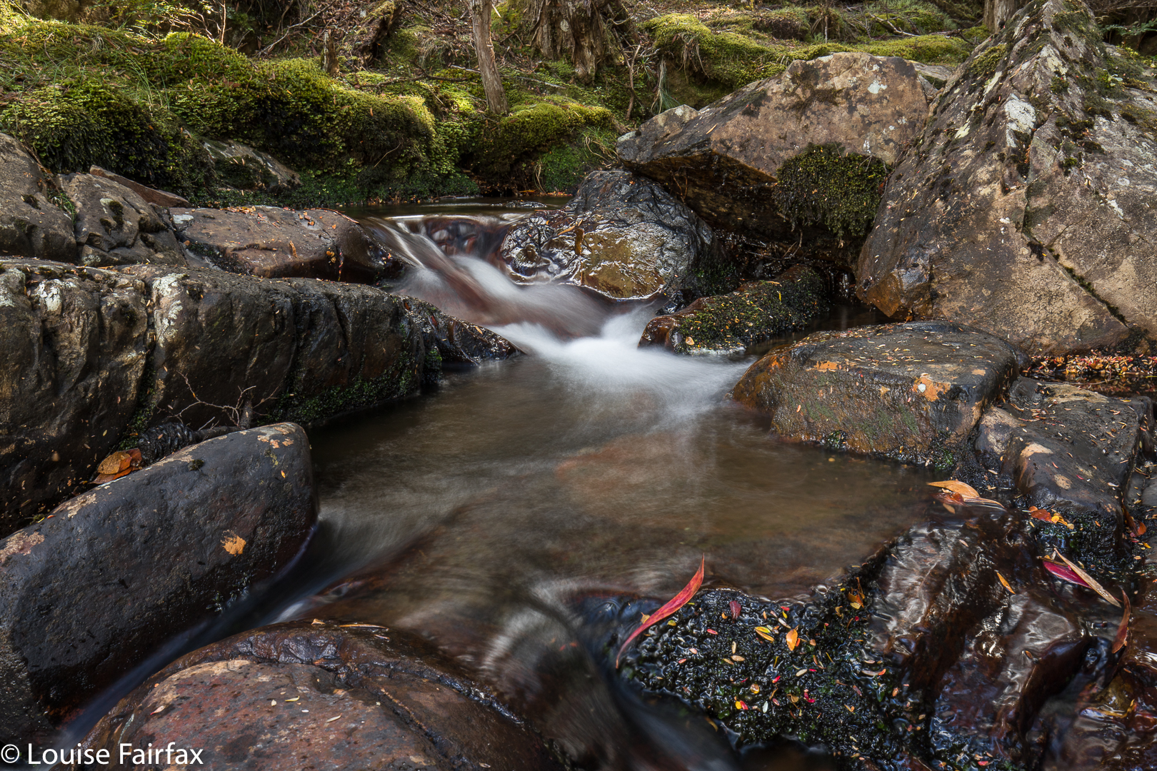
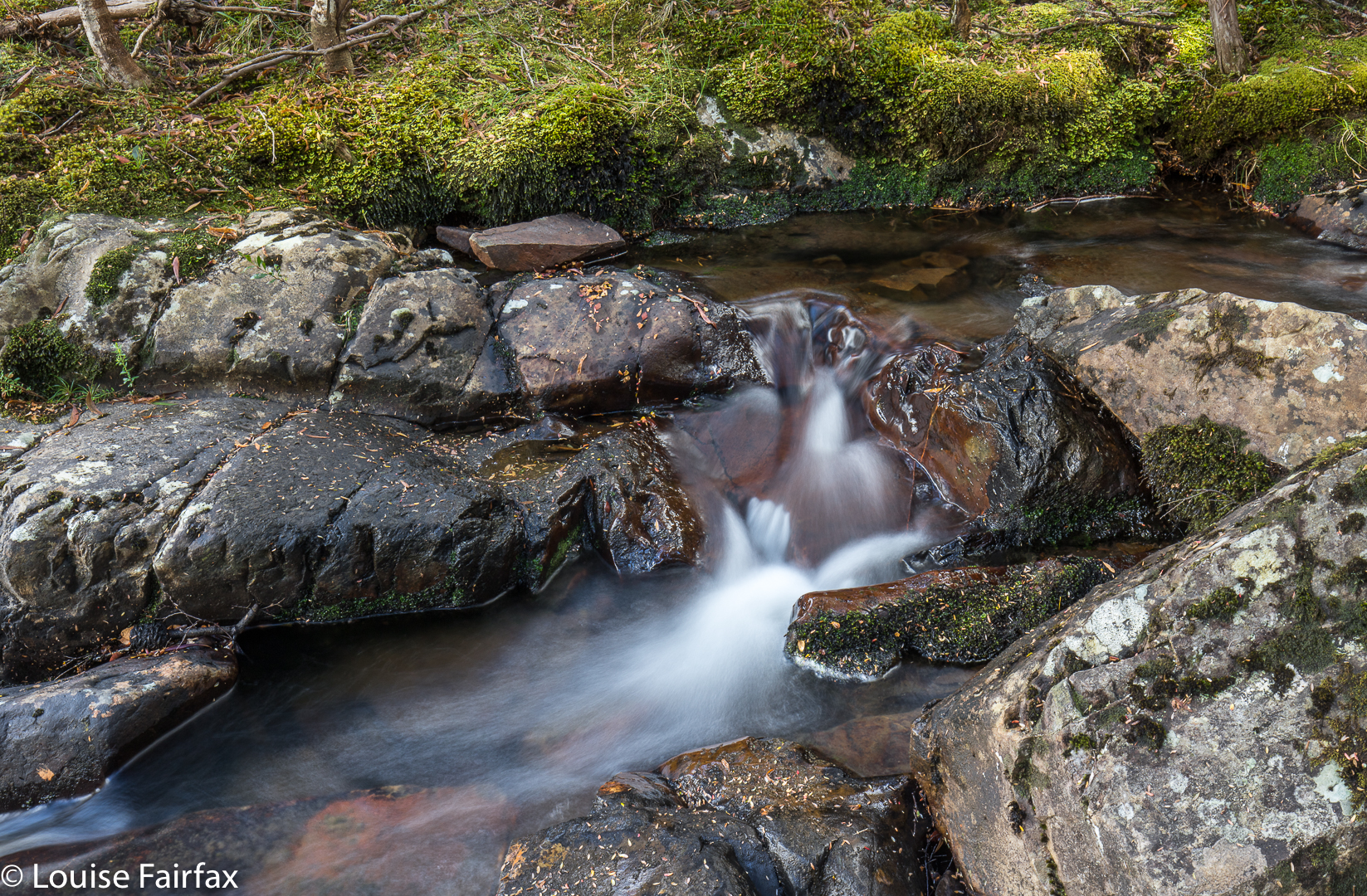
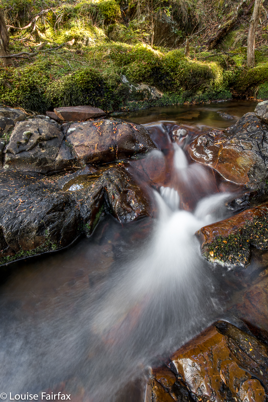 Cascade above Ralphs Falls
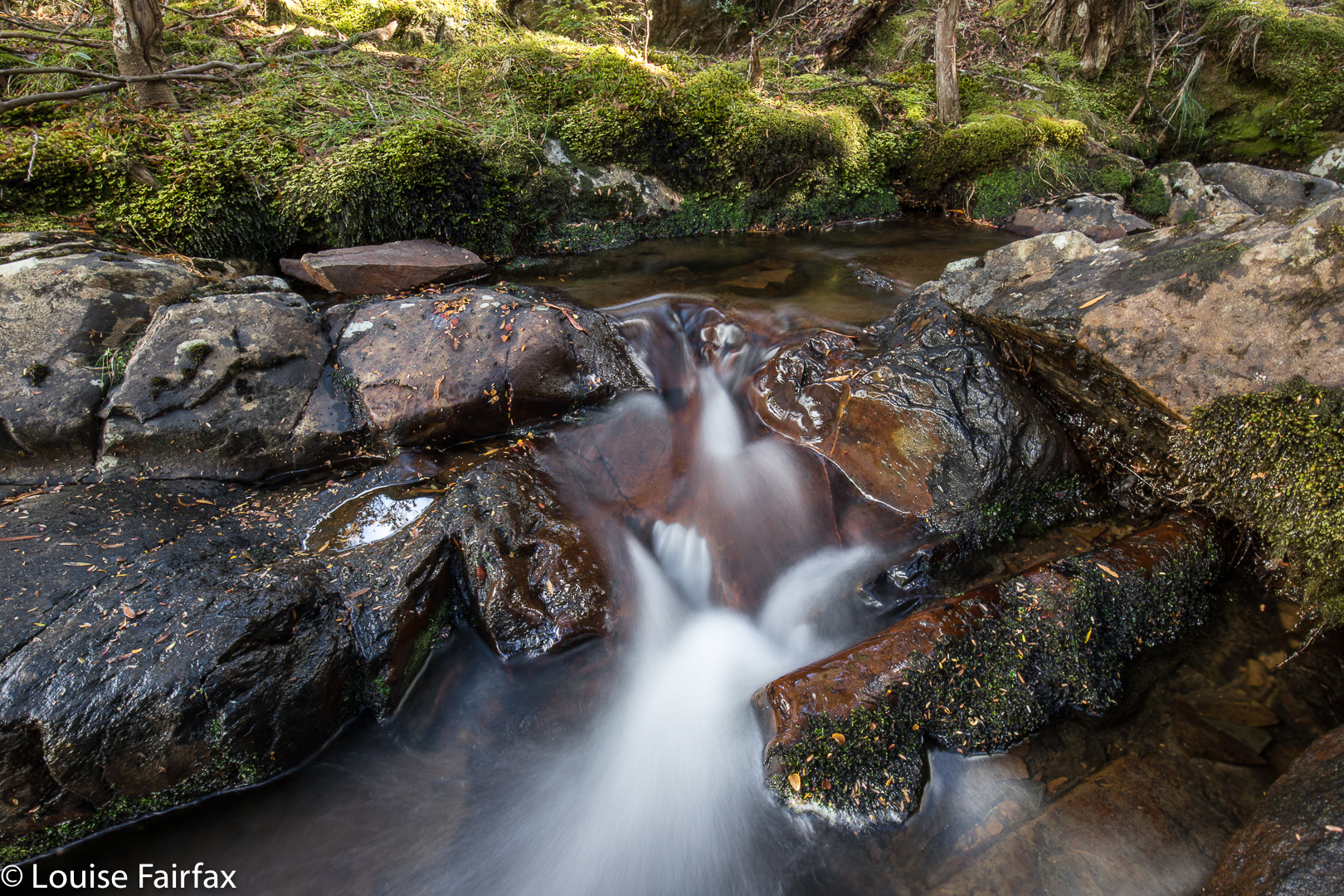
Off Carrie and I set. We were both struck by the extreme beauty of the forest. This, for us, outweighed anything the waterfall might or might not bring. The forest was an end in itself. Luckily I had asked Carrie to meet me nice and early, as, even at this early hour, the sun was casting shadows that were a little too bright for good photography. We enjoyed the fairy forest without photographing it. The falls were as ‘exciting’ as we expected, but we were glad to see the view, and to make the acquaintance of this Fall.
 On we continued around the circuit, wondering how long it would take. (Twenty four minutes, actually, which wasn’t a great deal of bang for the driving buck, but don’t worry, I extended it, as you will see). The route remained wonderful, with a sense of space beyond the trees that felt lovely. The forest floor was really open and clear – like a parkland – and we delighted in it. We got to a point where one could go down the steep, unknown spur to try to see the base of Cashs Falls, but we were both filled with curiosity still to discover what could be seen from above. Nine minutes’ walking after leaving Ralphs Falls, we arrived at the Cashs Gorge viewing platform, where we learned you could see precisely nothing of the actual falls. Hm.
The situation had not been right to go down the first spur that we could have followed (and then traversed in to the base). I had left a few things at home – like suitable clothes if it got any colder, and had forgotten to charge my gps which now read at 8%, bespeaking a crash at any moment. I had had a fire on my property in the late hours of Friday and early hours of Saturday morning, with very little sleep, and was not in a good headspace. Meanwhile, Carrie was wearing sneakers rather than boots, and it looked very steep down there. And, my tripod was sticking out, and would catch on all the bushes. I needed to have a different pack which could protect it if I was going to do THAT kind of bushbashing. However, now that we could see that we couldn’t see, we were disappointed, whilst still rejecting that first route to visibility for the above reasons.
Therefore, I suggested we follow the big spur opposite around to where it might give an opportunity of approach on that side. It was a beautiful route through more surprisingly wonderful forest, and we happened upon a pad, which a handmade sign said belonged to a Rattler Range traverse. We left that though, to do what I wanted. However, my tripod kept getting stuck here, too, once we started to lose contours, so we decided to come back to Cashs on a day where the flow would justify the bash, and on which I had a suitable pack for my tripod. Just in case, it would also be nice to have a gps that wasn’t going to faint. We had no risk of getting lost – I could have drawn a contour map in the dirt had Carrie wanted one – but for knowing whether you are above or below your destination, and other fine points of detail, a gps is of comfort. We went back to the car and fed her before doing the next falls.