
I felt unbelievably refreshed – and somehow cleansed – after my excursion to Hinman Creek Falls today. It’s hard to describe that special joy you have when you have been in the wilderness alone. In this particular case, there was probably an adrenalin release contributing. It was rather a scary little waterfall.
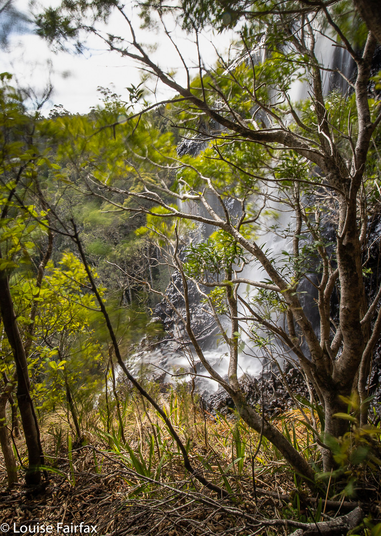
This is actually just a little waterfall above the top of the moster drop that begns just there where the white tumbles over. The sense of space and drop at this point was huge. I was glad of the trees in the picture to break any possible fall. If any bit of my camera equipment slipped and began to roll, it would be “goodbye” forever.
It has been a few months since I have had a proper adventure in Tasmania all by myself. Of course, I climbed everything in Iceland and the Faroe Islands by myself, but that is different from being in the Tasmanian wilderness, where you are much more alone and hard to find. I was so “alone” (but not one scrap lonely) that I went to text my girls to tell them where I was in case I didn’t make it back safely, but I was out of range. Oh well. I was being careful anyway, and I did have my epirb.
Hinman Creek Falls is one of many waterfalls that is just a blue line on a map that I noticed. This blue line is on the route to Cradle, near Moina. I did some research, and found that Clint of TasTrekker had been there, and noted that he had skirted private property the whole way there and back. It was on. I didn’t use his route, as there was no clear demarkation on the more northerly side of the property to be skirted, to indicate where the boundary actually was, so I went to the further, southerly end, where big overhead wires cross the main Cradle Mountain Rd, and where there is a clear fence on the boundary. It lasted all of a few metres. Oh well. I had my gps, but the bush is actually very thick, so I did stray over the black line when not walking with my face in my screen.
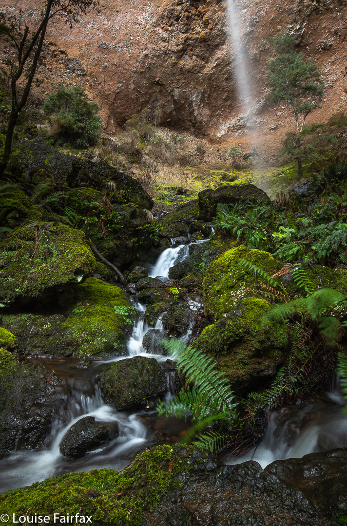
Bush rubbish was everywhere and trees crumpled in my hands. I came home with lichen in my hair and fern bits down my T-shirt. Using a line of least (but by no means no) resistance, and trying to keep clear of the mythical black line, I went mostly west until a bit steep changed to quite steep, and then picked up a water race that led me to the top of the falls (pictured above). There were endless possibilities to slip and drop 35 or more metres into oblivion. The edge is steeply sloping, and shiny slippery in many places that offer a possible view point. This is NOT an area for the inexperienced. I took a couple of shots from the top, feeling a bit nervous, and then followed the water race back SW for a long way, until my gps said I was way past the actual cliff drop off. I then descended sharply to a contour that was below the falls, and worked my way through the rubbish to its base. (None of this is private … just junky). The reward at the base was big, but I was worried about the way back, as so much of the forest had crumbled, there was fallen timber just everywhere, and I have seen too many tumbles resulting from a single crumpling of tree.
However, I need not have worried. I took a sharper route on the way back up, and it had less rubbish, so all was good. I found an old rope, but it had moss growing on it. I tested it for strength, yanking it hard, and it didn’t break, but I still didn’t want to entrust my life to an old rope, so avoided needing it and just used young trees and rocks instead. It took me 20 minutes to the top of the falls from the car, 22 more minutes to the base. Then, 18 up from base to top, and 22 from there to the car. (That split was longer, as I accidentally strayed onto private land, realised my error, so dashed south until I was over the line again). I was, as usual, starving, despite having a fulsome lunch once I got back to the car, so filled up some more at my favourite cafe in Sheffield.
Thanks for sharing your adventure 😀
Thanks ever so much Herman.
Hi Louise
Nice work!I went in on the North side,my map showed boundary all the way around the property!
I returned via the water race and southern boundary as you did.The north way was much easier and cross the creek at the top of falls and head down to where the old rope is.