
The story of Philps Peak begins as Day 4 of our Clytemnestra trip (http://www.natureloverswalks.com/clytemnestra/). On day 3, we had planned to climb to a beautiful spot near the summit of Agamemnon, but, most uncharacteristically for me, I had argued that the day was so stinking hot that it would take us hours to lug our packs up there, and that there would be no water for a day and a half if we went there, so we’d be better camping at the hut (Vera) and doing the climb as a day walk on the morrow. Angela agreed, but not with enthusiasm.
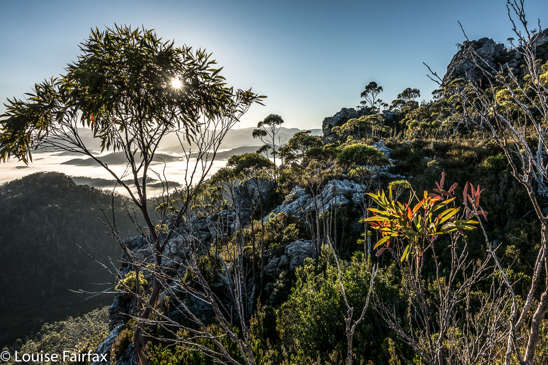
This little cairn marks the top of the first chute one climbs up on the way to the first hop, Agamemnon.
We chose a really beautiful camping spot – that is, the scenery was nothing particularly special, but the spot was secluded, set in forest with enough shade to cool but not enough to be dark. Birds and paddymelons visited us. It was just a very, very peaceful afternoon. Past ranger, Terry Reid, had donated a few bushwalking magazines to the hut, so I browsed through them, sitting in the forest on one of the many log-seats available, and organised my pack for the next day and chatted to the new people who later arrived at the hut and came past our idyll on their way to have a swim. I also had a lovely walk going back to the stream where I had noted that there was a waterfall that could perhaps be reached with a tiny bit of an offtrack detour. I was joined in this by new friend, Kent from Queensland, who also liked waterfalls and fungi.
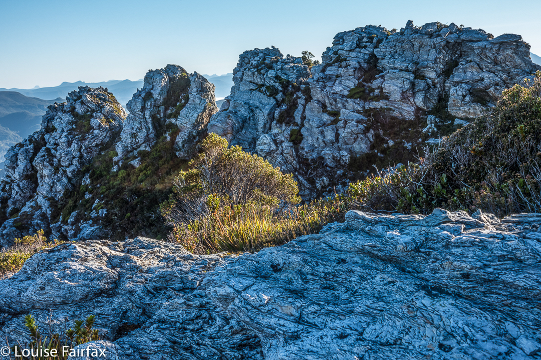
We call these rocks The Four Ugly Sisters. They lack a name on the map. One heads to the left of them on the approach side.
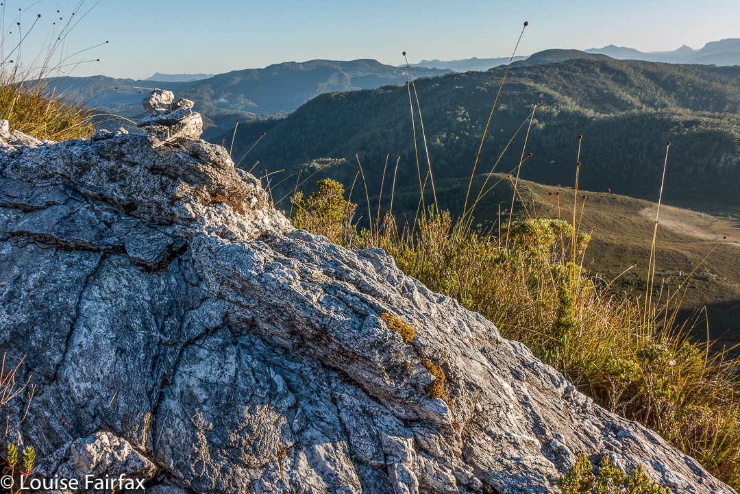
On summit day, we set out nice and early to get in as much distance as possible before the real heat dominated the day. The light was superb, and we had about two hours where the air felt fresh and the light was clear before heat and glare took control. This means we got to the summit of Agamemnon – and even beyond, to where you first have to lose some height – in pleasant conditions.
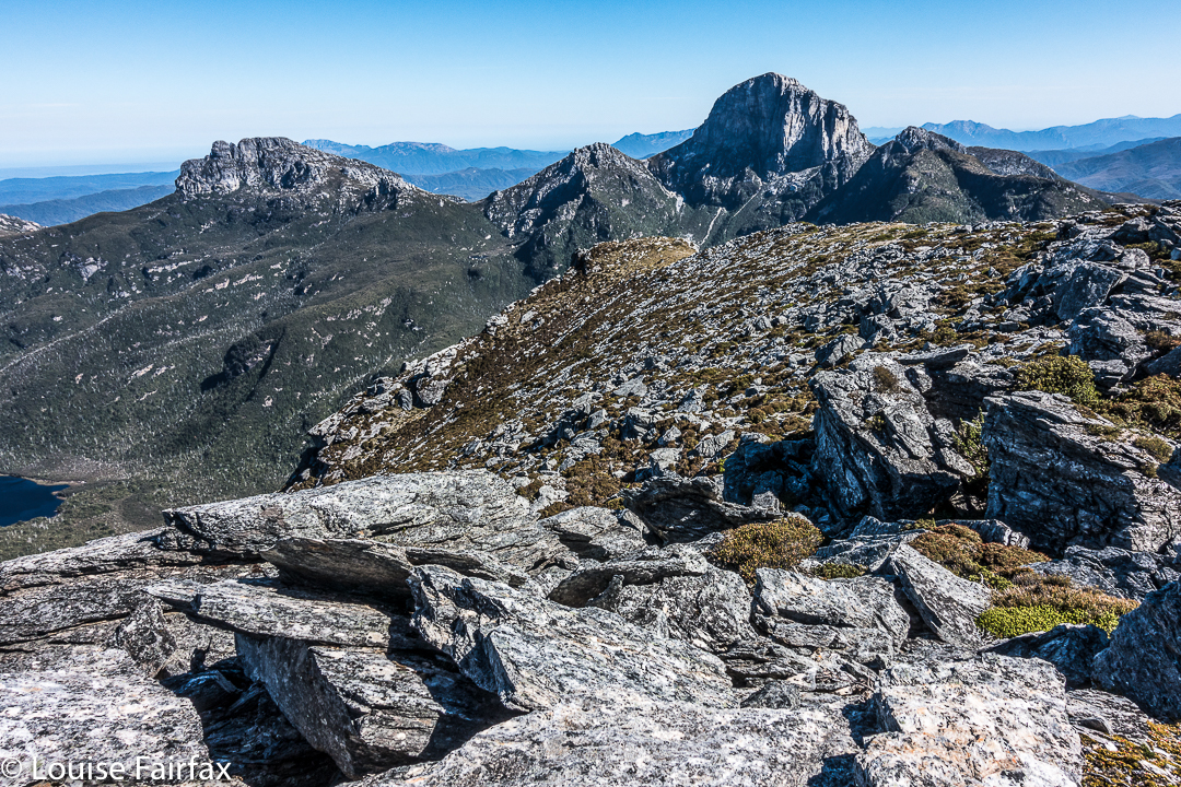
Summit view. That’s Frenchmans Cap and Clytemnestra (far left) dominating the scene.
In between Agamemnon and Philps, in a saddle before you climb up onto the main ridge that leads to Philps, we found a truly nasty bit of scrub, where the forest was dense and unbendable and a pain to get through. At least the scoparia wasn’t scratchy (too tall for that), but it sure resisted our attempts to push out to the other side. This hiccup didn’t last too long, however, and we have both endured much worse than that, so it hardly marred the day irrevocably, even it did detract from perfection. There must be a nicer way through that stuff, but we didn’t find it in either direction. It occupied maybe thirty minutes of our time each way (guesstimate – I didn’t look at my watch; it felt like that amount of time, but maybe it was less).
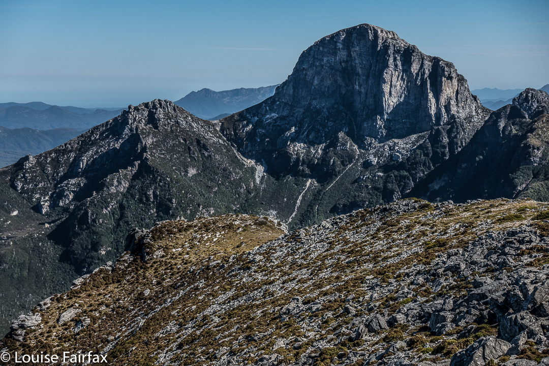
Frenchmans Cap in all its glory from Philps. What a grand hunk of rock.
Once we’d negotiated that obstacle, there were no more difficulties. We climbed up a chute to the high ground of the final ridge, and walked along its pleasantly open line to the final summit climb, which was not challenging. The sun was right in my eyes every time I looked up to try to see where the best line might be. That was perhaps the most difficult thing we encountered.
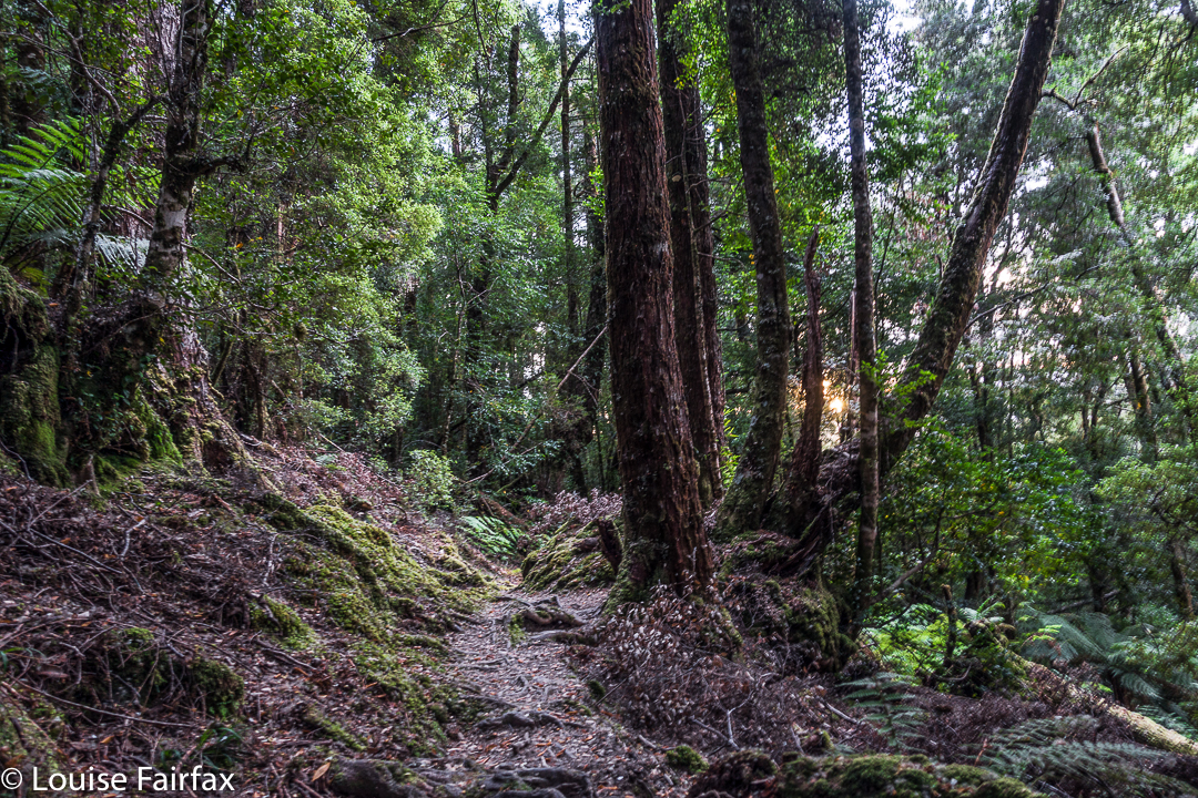
Forest next day on the way out.
On top, the view was amazing. I couldn’t believe how far visibility extended. There was Barn Bluff, days and days away, and Ossa, Pelion West and East, High Dome, Byron, Cuvier, Olympus. So many mountains normally not seen together, separated by many days walking if you are on foot. It was grand.
We tried for a better line through the junk on the way back (of course), but I think this one was even worse. I got so entrenched in scoparia limbs that I had to take my pack off and push it along the ground in front of me while I crawled under the unbendable tangle of wood. I thought for a tiny while that maybe I was going to spend the rest of my shortened life right here. No direction offered the possibility of movement.
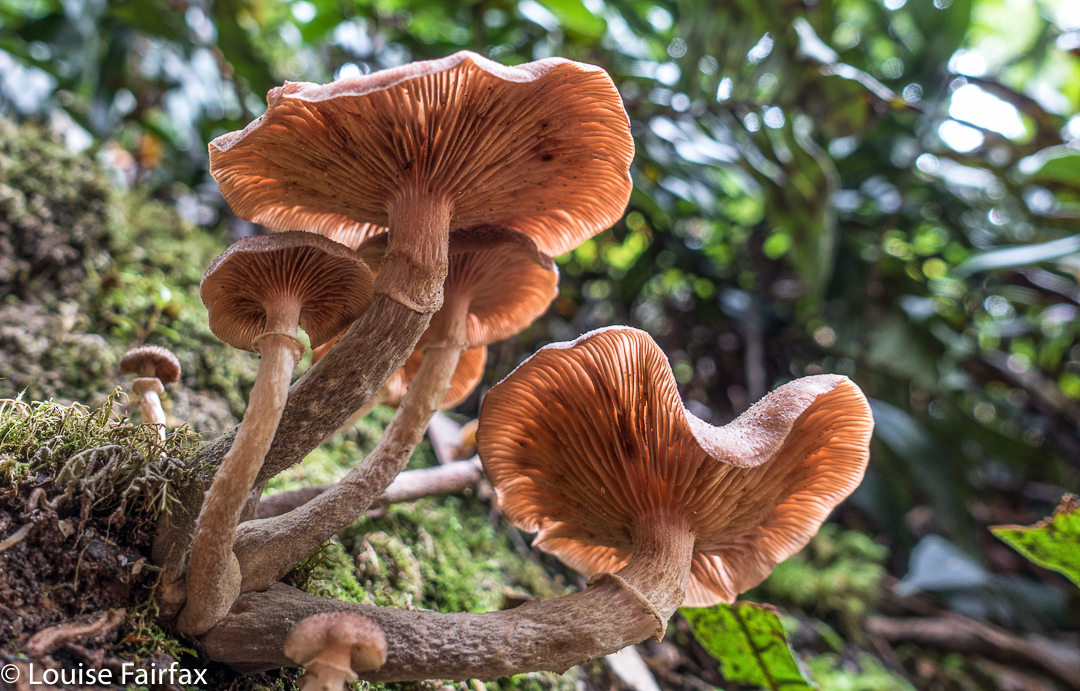
Yes, a few courageous (or ignorant / mistaken) fungi are out already, having heard that it’s autumn and not being aware that summer has just arrived.
Apart from that insult, the way home was uneventful. I was looking forward to a swim (yes, this is Louise writing) and ridding myself of these stinking clothes full of forest debris that had fallen down my neck as I tried to push a path through the bosky barricade. In the end, of course, I wussed out. I sat beside the little beach in my undies, staring at the cool waters, but letting the gentle breeze that caressed my bare skin do the job of cooling me down in the dense shade of that spot. It felt like a swim, but didn’t have the inconvenience of wet gear.
Hi
I’ve really enjoyed reading these posts about area surrounding Frenchmans Cap and have certainly been inspired! Originally my friends and I had planned to traverse the Western Arthurs at Easter but due to the terrible fires that will have to wait until another year.
So, we have decided to spend a week around Frenchmans Cap, hopefully taking in Philps Peak, Clytemnestra and Irenabyss (and Davern’s Cavern!)
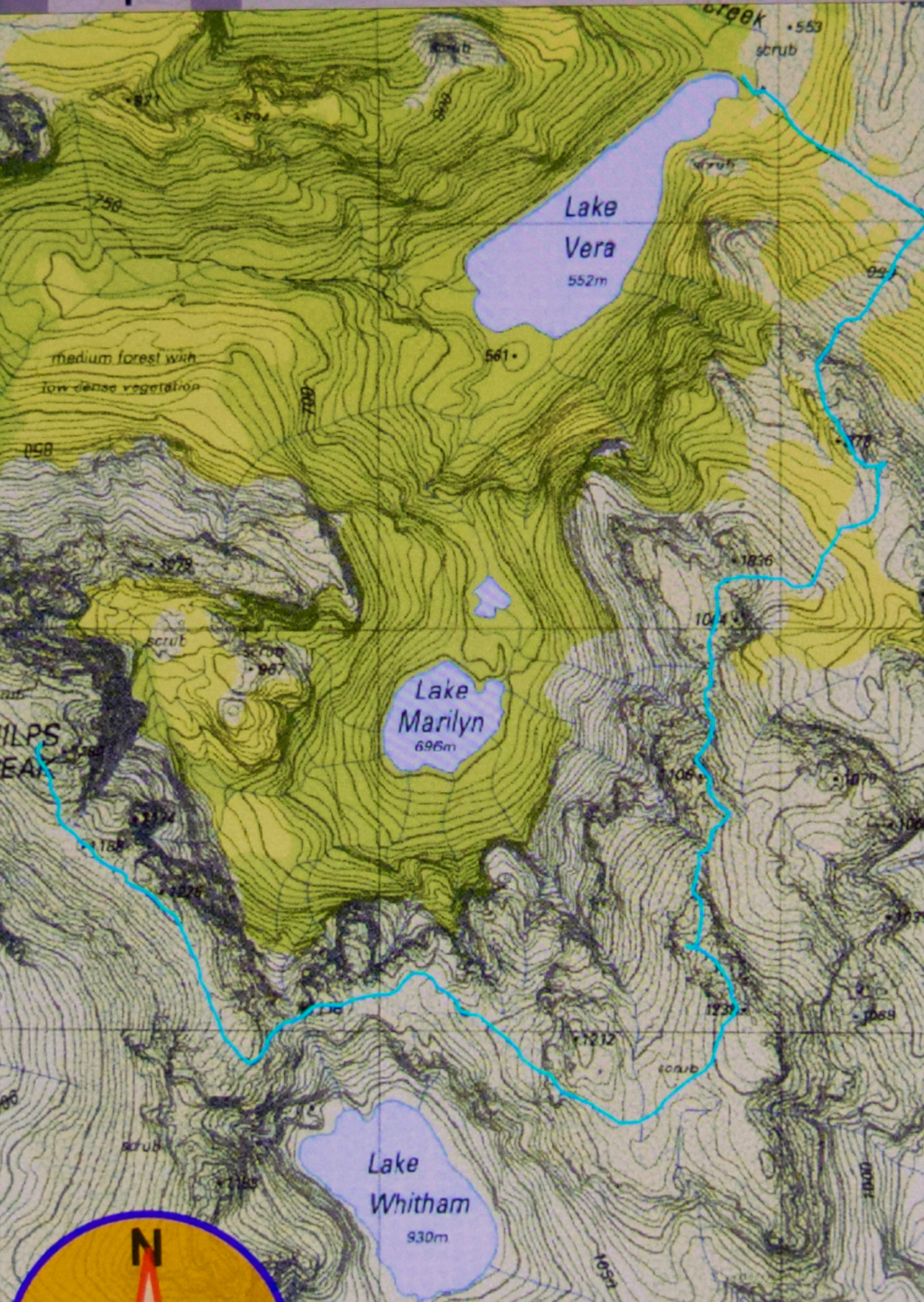
We are pretty competent and experienced and have acquired all the maps I believe we will need but being cautious I thought it might be an idea to ask you if you have any GPX routes you would be willing to share which you think may be useful for this trip.
We are hoping to camp overnight at Agamemnon if we find anywhere suitable, and possibly even camp at Clytemnestra but I haven’t been able to find any information as to whether this would be possible. We might just take our packs and hope for the best!
It would be very much appreciated and I would be very grateful if you could help in any way.
Cheers!
Dean.
PS… gorgeous photography!
Hi Dean. I’ll send you the gpx for Clytemnestra by email.
Yes, Look up my blog on Agamemnon, and you’ll see that we camped up there. Camping is also possible higher, but we’d had enough by then. Water was a couple of minutes below us in a stream. This spot is just after you’ve climbed the first lot of cliffs and before the cliff maze begins. Phillips is also in the blog. We did it with day packs.
There is a tarn on the way to Clyt. It is flat on top with great views, but it could be a dry camp at this time of year. You’d have to cart water for quite a way I fear. (Better in spring; then you’d have water from meted snow.)
Hope that helps. Let me know how you go. Cheers,
Louise
Hi Louise,
Another nice write up! The navigation looks fairly straightforward in fine weather but I’m wondering if you could email me your Philps Peak gpx track just in case the weather is not kind to us when we are there next month?
Many thanks
Jim