
Norman Bluff 31 Oct 2018
Norman Bluff is a pretty perfect daywalk if you are relatively fit and know how to navigate. It involves glorious off-track, yet easy, alpine walking over the tops of Battle Ridge past Mt King William I. Even with the drive from Launceston (as we had) or Hobart, it is attainable. I am lucky enough to have a group of friends who are sensible enough to clear Wednesdays from their work schedules to go to places like Norman Bluff in the middle of the week. Off we set.
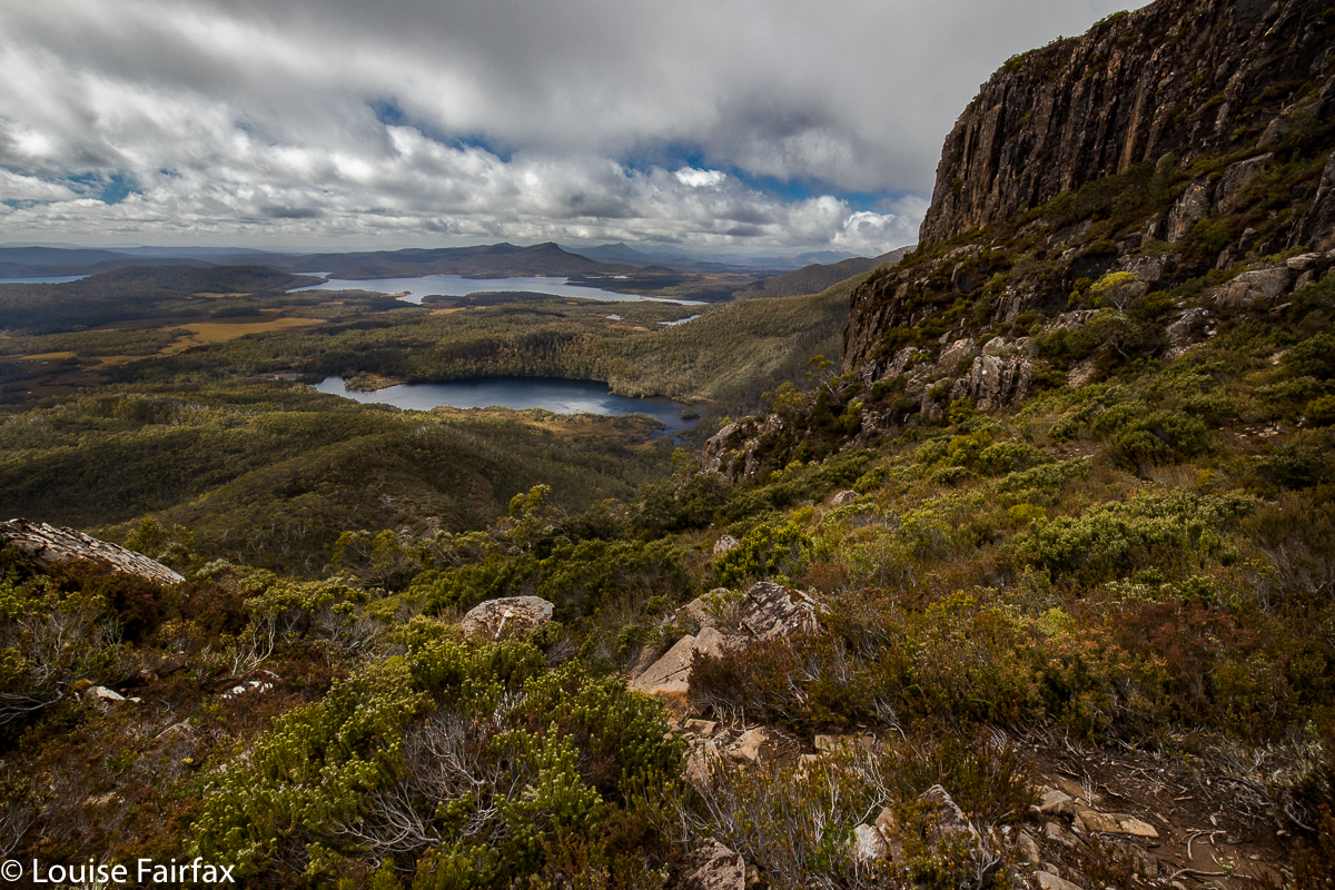
Above: King William I view from near the top to Lake George and the Guelph Basin
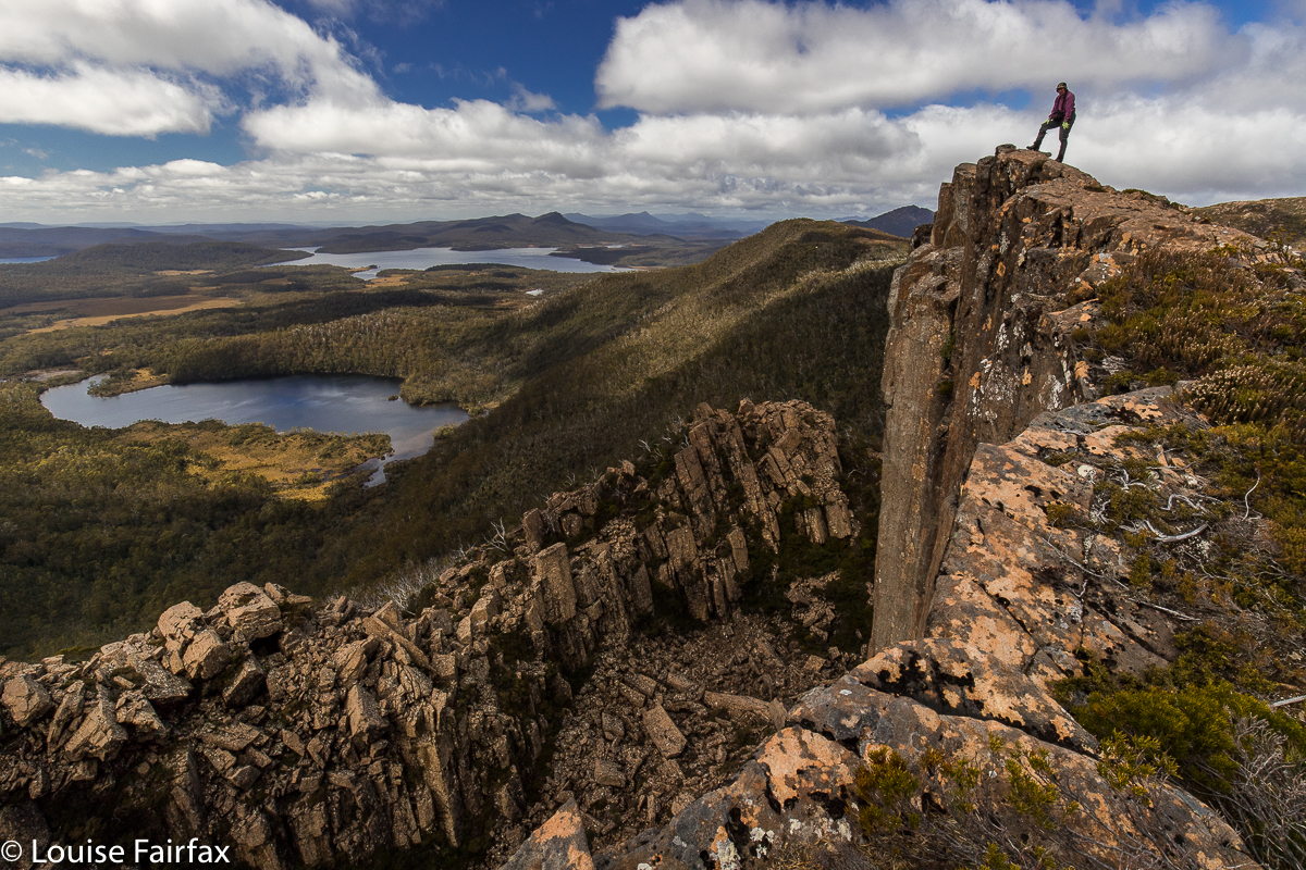 Guelph Lump, Phil, to Lake George, Guelph Basin, Norman Bluff
Our route took us over Mt King William I (steep climb) and “Guelph Lump” (what else are you supposed to call an interesting looking lump that is just before the beginnings of the Guelph River?) to a lump that I dubbed Deposit Lump (as we “deposited” several from our party there, to be picked up on the rebound) and on to our lunch spot, some delightful alpine tarns just before the climb (minimal) to our goal for the day, Norman Bluff itself.
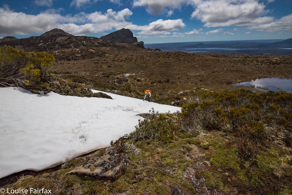 Climbing to Deposit Bluff, Diane (King William I and Mt Pitt behind)
Norman Bluff was actually, truth be told, a bit of an anticlimax. Das Gehen war das Ziel (The ‘going’ was the goal). Not only was Norman Bluff not the ‘enjoyment highpoint’ of the day, it was also not the physical highpoint. Both King William I and the Battle Ridge Highpoint (visited on the rebound) were higher.
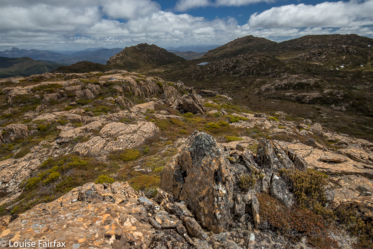 Deposit Bluff to Mt Harold and Milligans Peak. Frenchmans Cap behind left
I am not a lake or tarn bagger. There are just too many in Tasmania, but if I were, I could have ticked off Wessex Tarn, Odo Tarn, Lake George, Lake Vincent, Lake Eva, Lakes Adella and Arlet and the Guelph Basin of Lake King William. I could see Mt Ida, but I don’t think I got a glimpse of Lake St Clair – it was a bit hazy in that direction, or perhaps I wasn’t high enough. I am a waterfall bagger, and Saxon Creek Falls were very clearly visible, but that was not a first-time bag. I nearly died at the hands of that waterfall on our first encounter (2012), when the rock I was standing on shot out from underneath me as I scaled the falls, and I was left dangling uselessly from a tree root with a three-day pack on my back, drenching wet but with nothing for my feet to use, and arms losing their strength with each passing second. Luckily I had just written my will before I left home. The drop below did not bear contemplation. Fortunately, a fast-reacting Rod got my arms and somehow disconnected pack from girl so that I could pull up my own body weight. Phew. I will not forget Saxon Creek Falls in a hurry. Please do not try to tell me they are insignificant just because they don’t have a little blue line over the creek on the map. These matters are utterly arbitrary, and dependent on the will of a bureaucrat in an office somewhere. The drop would have killed me. The climbers below were too small for comfort, with horror written in their bulging eyes. How odd that I had time to notice that detail in what might have been my last few seconds. But this trip was a happier one. I could just wave a jaunty “Hi” across the valley and greet them from a safe distance.
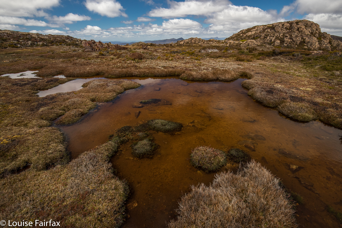 Lunchspot tarns. Norman shelf
The day was a little hazy, but mountain views of the many, many Tassie peaks in our purview were also enjoyable, as was the alpine walking around tiny tarns and intricate pools of pure, clear water, with flowering cushion plants and fruiting pineapple grass at our feet. How lucky we are to live in a place where such thrills are there for a day walk.