
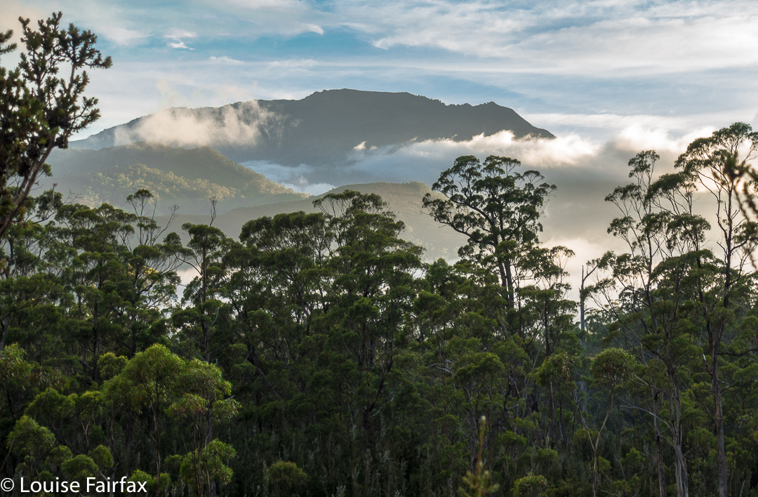
Beautiful morning on day 1 to begin our mission.
When I first heard that to climb Clytemnestra one needed to drop over the edge of Frenchmans Cap, I was filled with horror. Do you know the cliffs that shape the Frenchman, my reader? They seem formidable from any distance. However, the notion of climbing all the Abels had been planted in my brain by my former climbing partner, and had taken root there, and if I wanted to achieve that goal (still not sure, actually), then I needed to conquer any misapprehensions I felt with regard to dropping off the Frog’s hat.
Climbing Frenchmans
Off Angela and I set on the start of this little mission, past Vera Hut too early for lunch, which we had upstream. In case you’re also there in a dry time of year, I’ll tell you that the last water after leaving Vera is about 45 mins up the track, where it crosses the creek for the final time. We arrived at Tahune Hut mid-afternoon in plenty of time to choose a scenic spot for out tents, to organise our gear, and to go swimming (Angela) or to chat with others (Louise). I must have sweated a lot, as I needed a copious and salty afternoon tea, staring out at mountains reflected in the amber waters of the lake.

Our plan for day 2 of our venture was to set out at 7 a.m., but at 6 the continuing sound of heavier-than-we-liked rain had us push back the time to 8, … and then to cancel the idea of climbing altogether. However, at 10 it looked as though it might be clearing, so we decided to give it a go. Maybe this was a recce, maybe this was a climb. Time would tell. At least it was some exercise for the day.

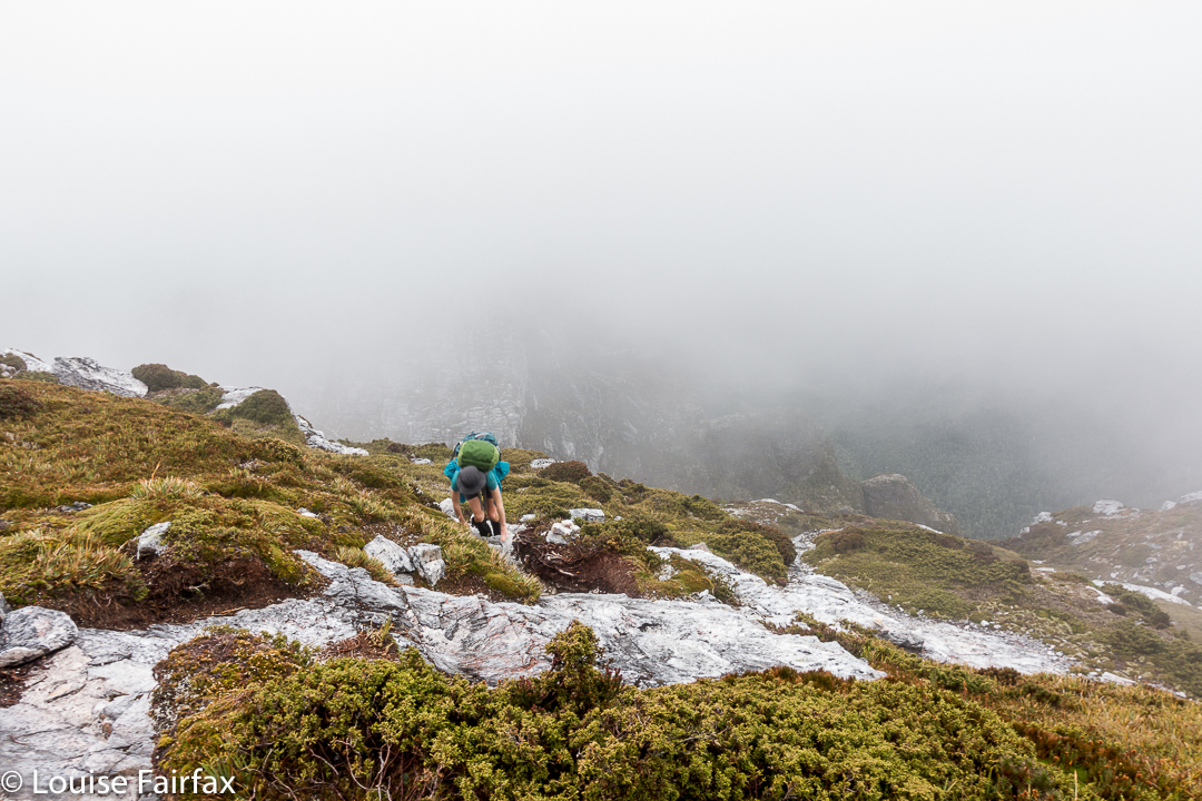
Getting near our goal by this stage
We were on top by 11, enshrouded in thick mist, but decided to continue this recce business a bit further, and to try, at the very least, to find where we’d drop off the cliffs on the morrow, perhaps saving ourselves time then. We attempted two chutes that ended abruptly in dead ends (excuse the pun), but on the third attempt, managed to negotiate our way down the slippery rock with success, which meant we reached a knoll near the two tarns at the mountain’s base, 1 hr 10 mins after leaving the summit. I was still in recce mode. Angela didn’t comment. On we pushed, now proceeding up the lightly bushed ridge that connected with the main Frenchman-Clytemnestra one, and then contouring around its belly to avoid unnecessary climb. When we rounded that bulge the mist cleared enough to give us a brief glimpse of our grail – way, way closer than I believed possible. Angela was now excited and announced that this was no longer a recce. We were climbing this thing and now. I would continue forward, but reserved judgement on the certainty of success.
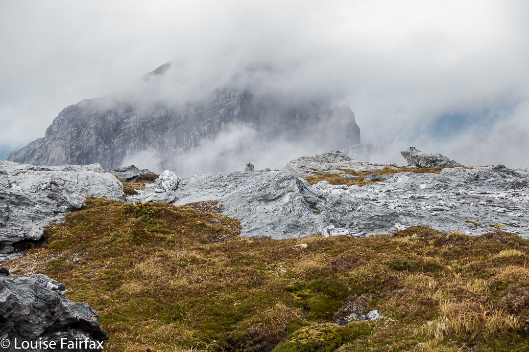
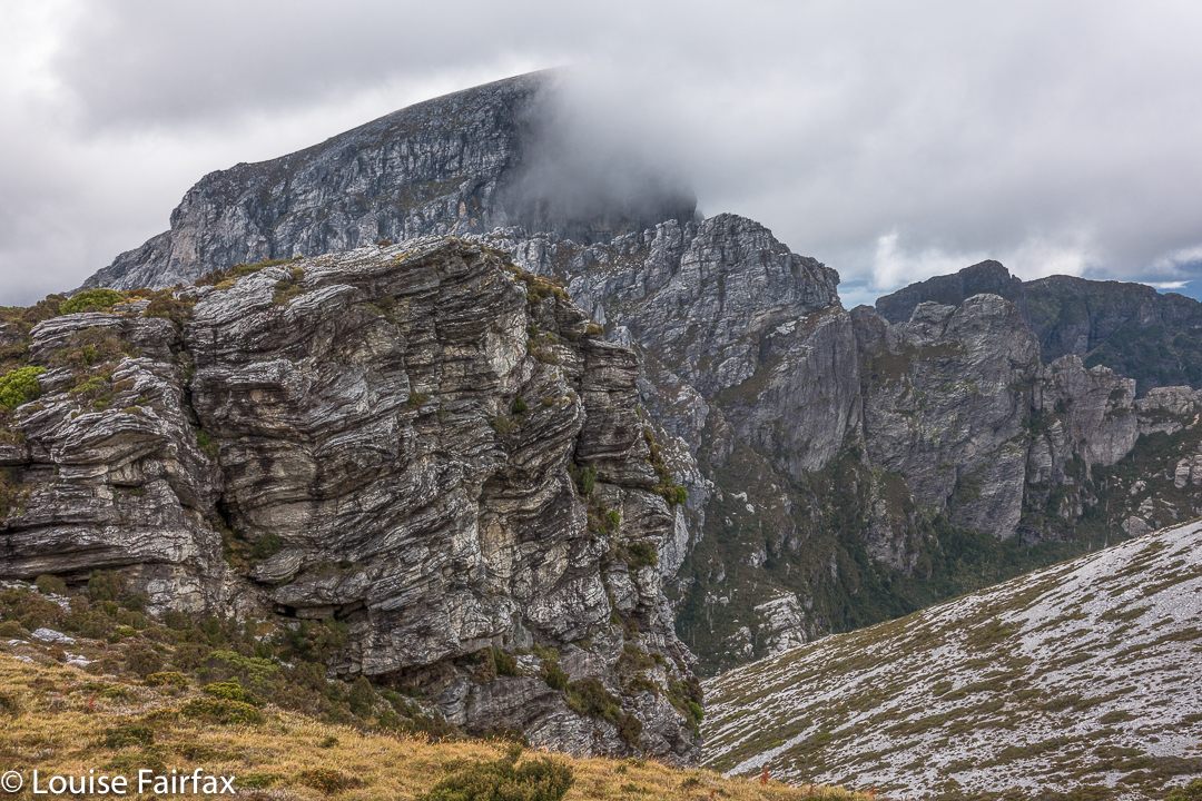
The cliffs of Frenchmans, teasing us while we had lunch on Clytemnestra
Into the final saddle, with only some cliffs between us and the summit cairn, I still refused to believe. Up, right, up, right, we climbed, walked, climbed, walked, until, truly amazing: there, fifty metres in front of me was the summit cairn. Only then did I allow myself to believe we were really going to do it. Ceremoniously we approached and touched together.
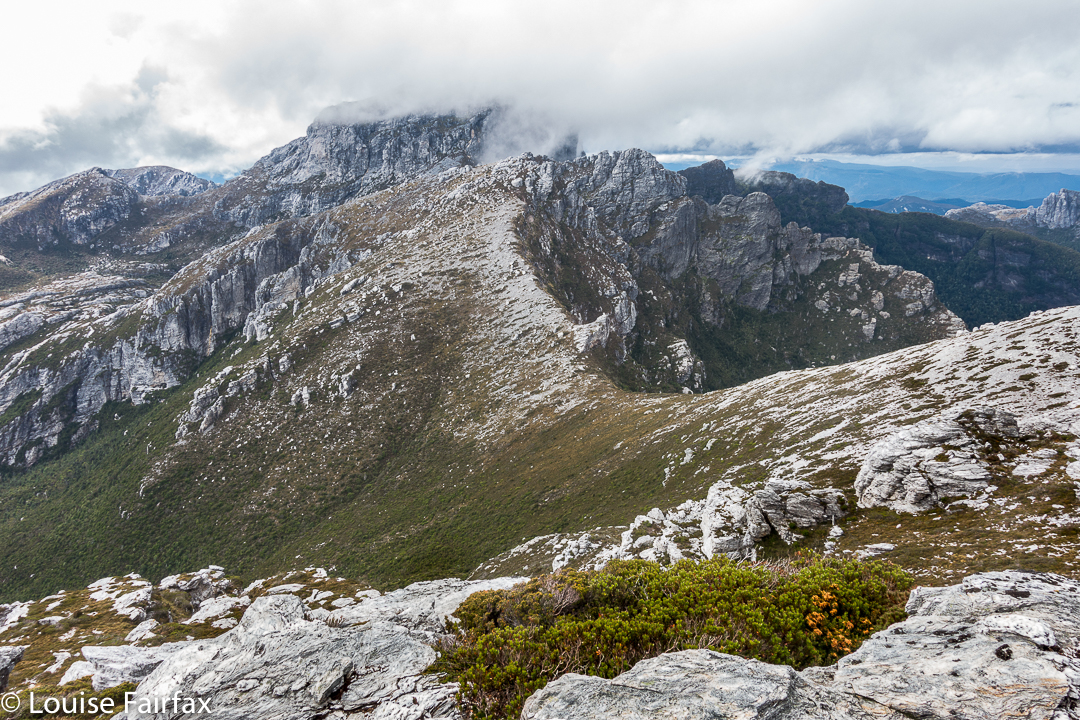
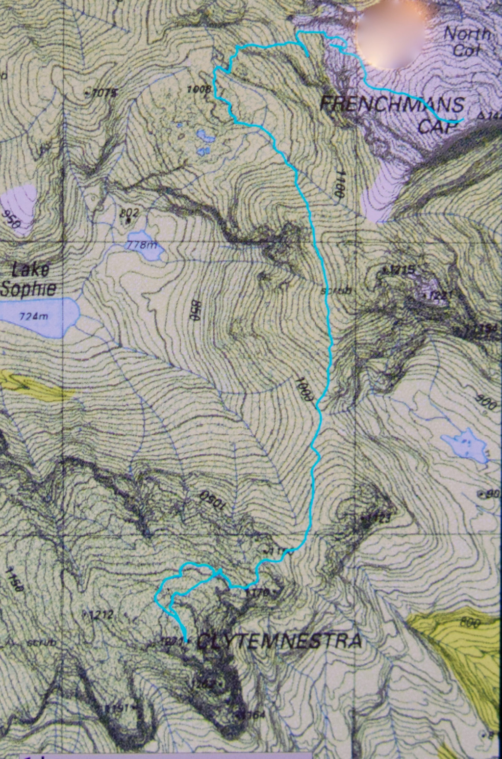
The route back to Frenchmans. We thought the mist was clearing!
We had lunch on top, watching the mist swirling around us, every now and then allowing a teasing half-glimpse of the silhouette of Frenchmans. At this moment, when I decided to consult my phone which had been tracking our route, I discovered that the battery was basically dead and I couldn’t even see the screen. Our homeward route was thus concealed, but, no worries, we have memories. Off we set.
We have to go over Frenchmans (back) before we drop down to our tents.
There were no mishaps until it came time to choose which chute we needed to use to climb back up onto the main massif. At that time, the mist was particularly thick: visibility was zilch, and it felt like hours later than it actually was, with so little light penetrating the thick clouds. I did not like this at all. It felt like these conditions were set in for the remainder of the day, and we would never be offered a glimpse of a possible route. We were in a nasty cliff maze with no perceptible way out.
Eerie light as the sun tries to break through (before giving up again).
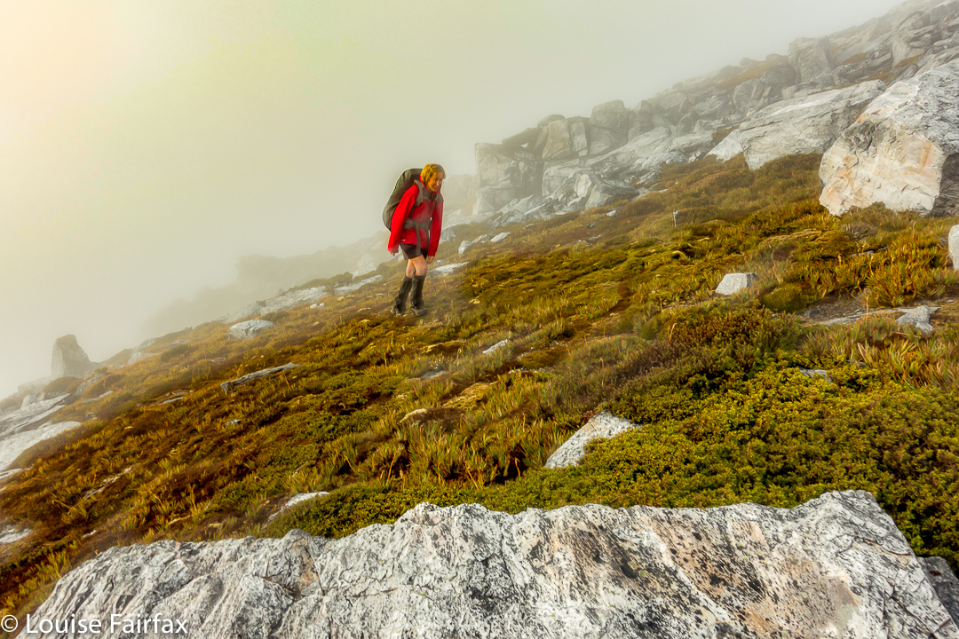
Luckily, before we left home, I had emailed Hobart Walking Club and received a gpx route, which I had transferred to my phone, and forwarded to Angela, who had also downloaded it. Now was the moment to consult this route on the phone that still worked. We could see the other club-member’s track, and our position relative to it, and note that we needed to contour a bit to the east before we would intercept it, and then follow it due north for about 150 ms, when, with luck, an attractive chute should reveal itself. It did. The feeling of relief as we emerged on top, and I knew that we just had to keep climbing – no more chutes, no more difficulties – was enormous. As we climbed higher, safe and sound, mission successful, a kind of golden circle where the sun should be coloured the mist and lent the landscape a temporarily yellowed hew. Everlasting daisies, in funny, closed cups, shone silver in the tinted light.
hello
we hope to do this frenchmans cap to Clytemnestra route in December this year. Would you be willing to share your GPS track? We are experienced hikers
Thanks for considering
Yes Tania. Can you email me your email address? (Mine is in my insta profile. However, as my husband’s memorial service is this Friday, I would appreciate it if you gave me some time before you do. There is lots going on
Hi louise
Im with the NPA bushwalking club and i was planning to spend about 5 days in the frenchmans cap area with some friends from the club.
We are all very experienced walkers and done lots of hiking in tassie over the years.
Would you consider sending me the gps track you took climbing Clytemnestra from FC?
Thanks Mark Goodson
(sent in a private mail)
Hi Louise. I am planning to do this walk in January. How long did it take you from the Lake Tahune Hut, up Frenchmans Cap, over to Clytemnestra and return back to the hut? Do you remember the distance also?
HI Heidi. It’s a great walk. Distances in country like that are totally irrelevant. I’ll give you all my time splits, so you can learn to “translate” before you start up Frenchmans itself. You will learn to multiply my times by whatever factor in order to get your own (even if the actor is a fraction). OK. Carpark to Lake Tahune hut (Day 1): 6 hrs 39 mins walking. Splits: 1 hr 35 to Loddon crossing. total 3 hrs 45 to Vera Hut. 1 hr 39 more to the Baron Pass. 1 hr 16 from Baron Pass to Lake Tahune. Day 2: 53 mins hut to summit of Frenchmans. 1 hr 10 summit to tarns below. 1 hr 33 tarns to summit of C. The whole day, Tahune to Clyt summit and back involved 7 hrs 17 mins walking. Nowhere do I ever include lunch stops or food or photography stops. They have to be added on. Angela and I tended to only stop at the summit and for lunch anyway (simultaneous). Photos of that sort are done mostly on the hop. Summit of F to tarns is messy in both directions. Beware of running late, as then panicky decisions about routes can result. It’s daunting country in a white out, which is what we experienced on our way back – most uncomfortable, and WOW what a relief when we found a way through the cliffs!!!!!! Once you’re on Frenchmans, then you can just roll down the hill in the dark if need be, but the route back up to the summit in reverse needs to be carefully done. Jan is great with long days. We only had short ones, and the risk of dying of hypothermia overnight. 🙂
Hi Louise – I have a group of 5 planning to do the Clytemnestra trip. If you could please send me your gpx file it would be much appreciated!
Regards
Mike Doyle – Devonport
Hi Mike. You should have received it by now. (email)
Hello Louise.
I am planning a 7 days trip with my brother to the Frenchmans cap area. I’d like to do the Clytemnestra side trip, could You also email me the gpx track?
Many thanks.
Sent 🙂
Hi Louise, Great report and amazing blog by the way. Could you please share the gpx track with me as well. I would be very grateful. Kind regards, Jacek.
Hi Louise,
Great write up! We are heading down Frenchmans way next Feb for a bit of an explore. Like everybody else, I’m wondering if you could email me the gpx track?
Many thanks
Jim
Hi Louise,
I love your walk write-ups.
Looking at returning to Frenchman’s Cap later this month, and contemplating Clytemnestra – any chance I too could get the GPX file?
Thanks,
Jack