Clumnar Bluff. Hoorah. Sixth time lucky – if “luck” is what you call it. I have at last climbed you. Both summits. And what happened on the failed attempts? Is it a hard mountain? No, it is not hard at all, although I was starting to feel that it must be. So, what’s the story?
Time 1) It was frosty with icicles on the rock, so it was called off before we began, and we climbed a slippery, icy Mt Victoria instead. (It’s not as high).
Time 2) We got started, but didn’t even get half way. It was raining and cold, and our organiser was still recovering from an operation. We were obviously not going to make it, so we all opted for the comfort of the car and to the business of pulling leeches off ourselves while we drove back. The count was 42 leeches thrown out the window on the return trip.
Time 3) This trip was called off because of rain before we left our homes.
Time 4) I put my name on the list, but then discovered I had a clash and a trip organised up a more important mountain. That group made the top, but without me.
Trip 5) I was told we were skiing to Clumner Bluff. HOW exciting is that? I was thrilled. However, in the car on the way, I was told we were not going to Clumner at all.
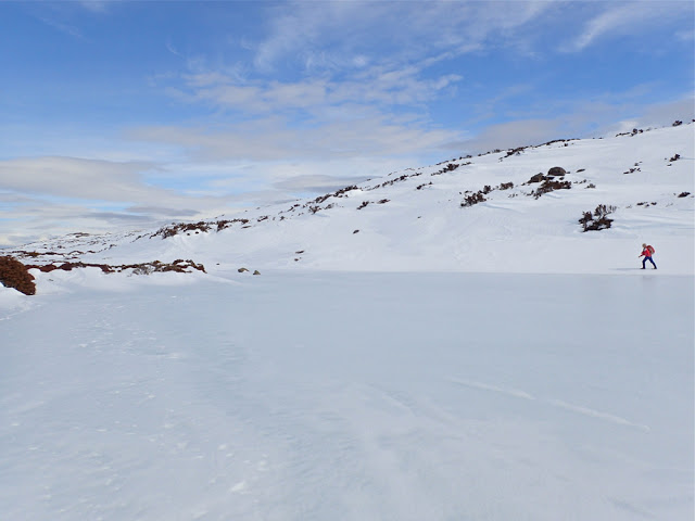 This is also not my photo, but one offered to me by another friend, Catherine, showing me walking around a different lake on Wednesday. This is very similar to what we could have been seeing had we been able to see, or had the luxury of time to stop and take it.
Enough was enough. Obviously it seems, if you want a mountain dearly enough, you need to take matters into your own hands. I studied the weather and decided Friday was good enough for a try, despite the fact that either snow or rain was predicted for the afternoon (depending on the temperature). An early frost would at least mean that the snow would be firm for the way out. It would be several kilometres across the top once I’d climbed up to the snow, so I wanted to make sure of being out by midday, just in case it got slushy and slow, and in case sinking with every step became a possibility. It thus needed to be a trip with a nice early start, and one done on the march with very, very few stops, if any. Who would be up for such a trip? My friend Angela, of course. I was so annoyed with five failed attempts that I was prepared to go solo if she couldn’t come, but luckily for me, she could, so when the sky closed in and even the ground became difficult to see, I had the warmth of company.
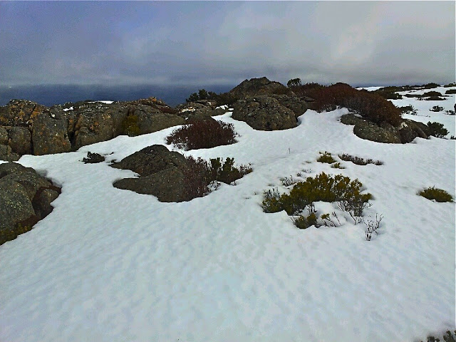
Angela and I, as a duo, now have, by default, a very good – yea, pure – record of summitting success in the snow, and this mountain was no exception. I say “by default” as we don’t always set out intending to snow climb. It just happens to be the case. This time, however, the snow was sought out and courted. I thought it would be great fun to have my first summitting of this elusive mountain in winter white. The fact that it was also in a grey-out, done half-blind, just added spice.
At first the day seemed benign. I thought it would be another glorious one, like Wednesday. However, once we gained a contour or two and were exposed to winds coming from the west, we were hit with an icy blast, and quickly donned another layer to cope with the freeze. We were not deterred. It was chilling, but we also both had many more layers in our daypacks in case. To the west, the sky began to look dark and ominous. I checked my compass to note our bearing, as the land was almost featureless. The clouds were rolling in, and yet it was still so bright because of the snow that we both found our gps screens very hard to read; I was glad of the paper map and compass we were each also carrying. Somewhere in the clouds, Clumner Bluff was hiding, but it was a matter of belief, not of seeing – a belief based on the accuracy of map and compass, for the eyes told us nothing.
The ground became exceptionally hard to discern. I changed from sunglasses to red-tinted ones, but I still couldn’t detect any helpful patterns in the snow that indicated where the ground was. Like a little old lady, I walked bending low to try to make out the ground. We crossed something we decided was a lake, treading very gently indeed as we crossed it. We had no idea how deep it was, or how stable the ice covering on top. I was so glad to have Angela’s company!!! On the return journey, we evaded that bit by doing a wide arc.
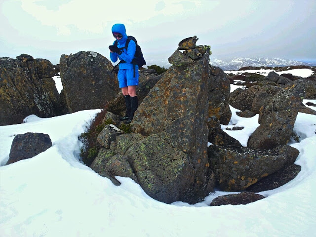
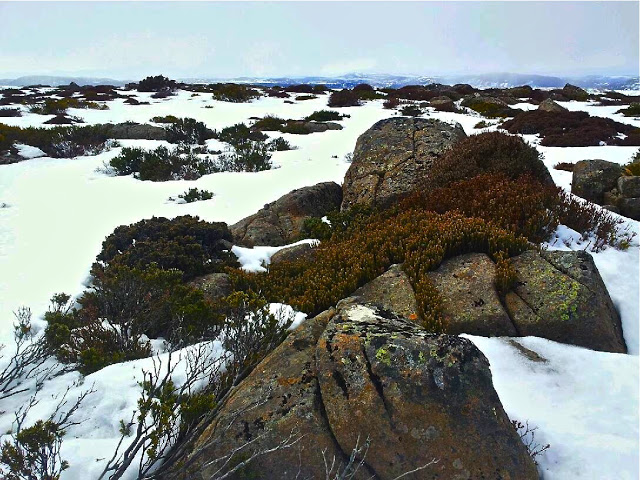
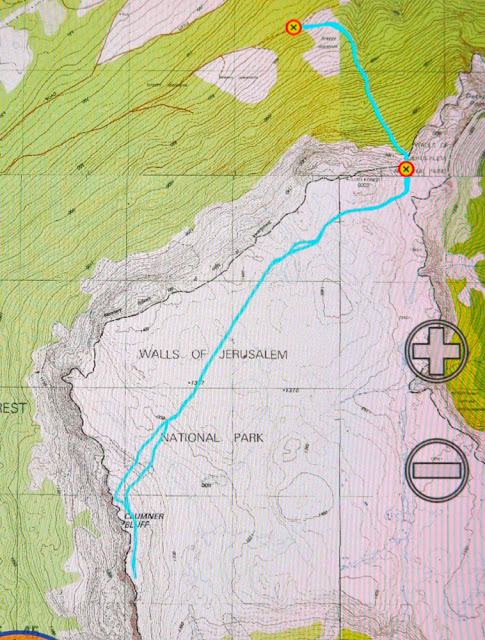
After maybe 50 minutes across the snow, a shadowy lump loomed up ahead. This must be Clumner Bluff. At last we come face to face. ‘Odyssea’ meets her giant. Up we climbed and exactly 60 minutes after cresting the snowy tops, we were standing on what we supposed was “summit B”. I assume this is the “historical summit”. However, even in the grey misty gloom, our eyes said there were higher things to our left (south). My old map told me nothing, as it lacked a black dot of any description for the summit, but Angela’s more modern map had a summit where our eyes said one should lie – apparently 10 meters higher than the one we were on. I really don’t know, and never will, if I would have had the courage to go even further into the dark mist and visually unknown without the company of a friend. I don’t need to know right now, as Angela agreed that we’d go on to touch the highest point, and not just this cairn and summit. It took us a further 15 minutes to reach it, but they were glorious minutes where we felt even wilder and freer than that first hour across the snowy plateau. Somehow or other this was the ultimate: wild and free on rugged eerie tops with wind so noisy we couldn’t hear each other speak; the only marks in the snow were wind waves and the tracks of wombats and wallabies. It was fabulous. And oh was it good to breast that summit rock and know we had at last got to the top of the runaway mount.
Here, after 2 hrs 15 mins walking from the car, we had our first break, if you call it that. I took four photos. Angela similar, and then we were away again. No food; no drink. We were still both in a hurry, as the weather really was quite nasty, and we both wanted to reach this nice thing called safety before we ate or drank or wasted any time. We had our first break from earnest progress, and I had my first drink and food of any description after 3 hrs 45 (12.15 pm), when we were successfully out of the snow, and about a quarter of the way back down the mountain. I had been right to think we needed to be out by midday. The snow had been a little sludgy towards the end. It started raining lightly as we tightened our seat belts to drive away, both feeling quite excited by the day’s adventure, and very, very satisfied with all that had happened.
For the first time in my very long life, I forgot to take my camera with me!!! It was in the car, but I thought it was in my pack. I realised 10 minutes into the walk that this was the case, but was not prepared to lose 20 mins getting it, given that I had calculated that we needed to be out by midday. As it was, our progress was so purposeful that I would possibly not have had time to use it apart from at the summit anyway. Wednesday was about photography; today was about business – if you call feeling the wondrous expanse of infinitude in nature’s wildness “business”.
16 kms; 500 ms climb = 21 km equivalents. 4 hrs 45 walking (plus lunch and four photos).


